
 |
Floods
|
Back in Roman times, the area we now now as The Norfolk Broads was under the sea. In place of the rivers and lakes we see today, there was a great estuary. The Romans used the estuary for their ships and guarded the entrance with the forts at Caister and Burgh Castle.
Today, Ludham seems miles from the sea, but back then it stood on a bit of high ground looking out over the sea towards Flegg Island. The map below shows the extent of the estuary.

In a way, you could regard the situation in Roman times as the ultimate flood. Ludham was surrounded by the sea.
Since Roman times, the sea has retreated and the great sandbar at Yarmouth has formed. The estuary vanished with only Breydon Water remaining, and Ludham was surrounded by the rivers Ant, Bure and Thurne rather than sea. However, the surrounding land has not got any higher and is still effectively at sea level which means that this area is still prone to flooding both from heavy rain and from the sea. You get a bit of flooding most winters, but every now and then, the big one comes along.....
Here is a history of flooding in the Ludham area in words and pictures:
Historical Floods
We know from written records that major floods happened in the area in the following years:
1280, 1289, 1361, 1519, 1570, 1614, 1646, 1734, 1762, 1767, 1770, 1807, 1878
Many of these historical floods are recorded in stone on a wall in New Mills Yard, Norwich.
The 1912 Flood. A big one.
On Monday 26th August 1912 it rained for 12 hours and a massive 6 inches of rain fell in that short space of time. The resulting floods were devastating. The Aylsham navigation was washed away and never reopened. The center of Norwich was flooded and for a time even the cathedral was under threat. Ludham Bridge was damaged by the flood water but at least it survived unlike the bridge at Coltishall which fell into the river. All the low lying land in Ludham was flooded but the center of the village was high enough to escape.
The Boardman family from How Hill were out with their camera recording the event. Here are some pictures.

Edward Boardman on a flooded marsh near How Hill

Floods at How Hill Staithe, Ludham 1912.

Edward Boardman and his children need a boat to cross flooded fields

The remains of Coltishall bridge over the river Bure. The flood also washed away the locks of the Aylsham navigation.
Damaged property at Coltishall
Further damage at Coltishall
1938. The Sea comes in at Horsey
The low lying land surrounding Ludham is always vulnerable to sea flooding. In 1938, the sea defences were breached at Horsey causing widespread damage and flooding. Again, the Boardman family were on hand with their camera. Here are some pictures of the aftermath they took on the 17th February 1938.
The scene at Horsey Gap where the sea came through the dunes

Looking towards Horsey Hall from the Mill. Flooded fields.

Looking inland from the dunes

Horsey Mill stands marooned in an inland sea.

Somewhere under here is the Horsey to Sea Palling Road

Whiteslea Lodge on Hickling Broad is now in the Broad.
Here are some further photographs of
the Horsey flood from the album of Mrs Brooks at
Ludham Manor:


1953 The Devastating Sea Floods
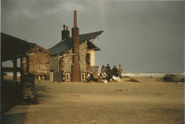
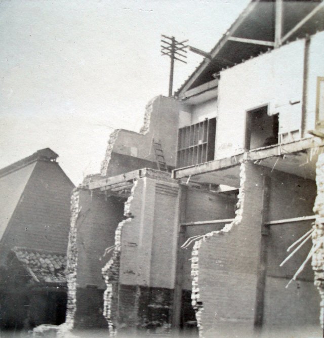
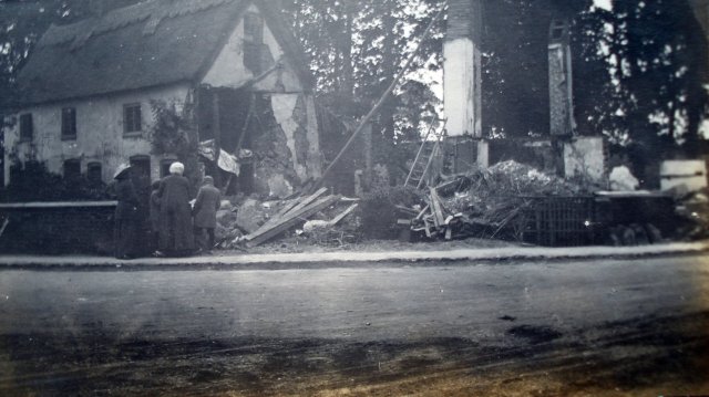
Damaged buildings at Sea Palling

Further damage at Sea Palling

Buildings behind the dunes were badly damaged
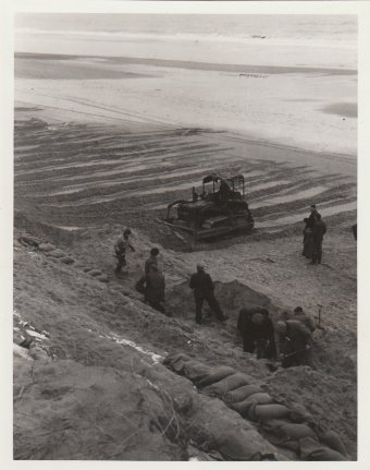 |
 Teams repairing the dunes at Horsey |
 Right: Wooden buildings stood little chance |
 |
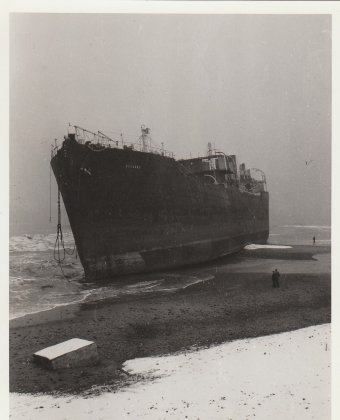 A large ship is washed up on the beach |
 |
Other floods
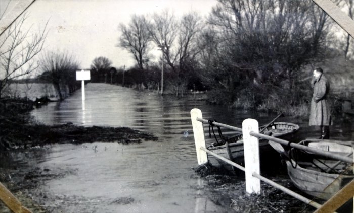
Flooding need not be a problem if you are prepared for it. For example, the bungalows along the Ludham Riverbank of the River Thurne are built on stilts so that flood water simply passes underneath.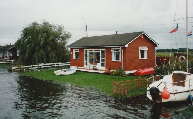
The gardens of these properties are flooded most winters. This is 1994
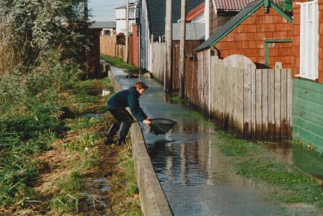
Catching fish on the footpath behind the bungalows 1994.